
LOG IN

Western Technologies Group LLC is the premiere provider of Flood Determinations, Tidelands Reports, and Property PEEK Reports. We serve various industries built around the real estate transaction. Our clients range from Title Agencies and Mortgage Lenders to Realtors, Appraisers, Engineers, Attorneys, Surveyors, and Builders.
Our company mission is built on integrity, accuracy, and innovation. We pride ourselves on the INTEGRITY of our people, processes, and data; on the ACCURACY in our results and analysis; and on the constant INNOVATIONS we develop to anticipate the needs of our client and bring solutions to the ever-changed business world.
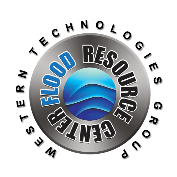
Our Flood Resource Center is at the core of our mission. Being staffed by Certified Floodplain Managers (CFMs) the Center provides WTG Clients and their interested parties with information, support, training, and resources related to flood and tideland issues. Our specialists are also on the pulse of changing regulations and cutting edge solutions to real-world challenges faced by the industries and people we serve.


The Flood Resource Center is at the core of our business. It provides customer support, LOMA application services, engineer and surveyor referrals, report analysis, web-based flood related content, and educational outreach.
The Center is staffed by highly trained professionals, including Certified Floodplain Managers, GIS Specialists, Flood & Tideland Analysts, and Training Specialists.


Click a link to preview each webpage.
Flood Map Update Schedule (FEMA) Commercial Flood Coverage (FEMA) State of New Jersey, Sandy Recovery Division Hurricane Sandy Housing Resources Center (NJ Housing & Mortgage Finance Agency) Hurricane Sandy (Wikipedia) Superstorm Sandy NASA Images Storm Track Hurricane Sandy New Jersey Relief Fund National Hurricane Center
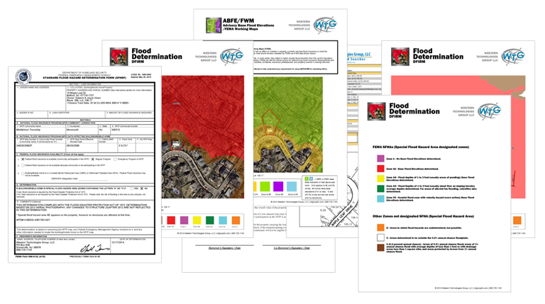
The first step in understanding your flood risk is to obtain an official insured WTG Flood Determination. This determination will provide important information regarding the flood zone affecting structures on your property.
WTG is available for consulting and analysis on any report that we produce. From the title agent right down to the homeowner we are here to help. If you have a WTG determination you have access to the expertise, understanding, and guidance of our trained flood specialists. We are always just a phone call or an email away.
We can also help answer questions regarding steps that can be taken to lower insurance premiums for structures that are affected by a high risk flood zone. The first step in any high risk situation would be to obtain an elevation certificate. This is an important document to help you understand the next steps in lowering your premiums.

WTG Flood Determinations establish the true flood status of a property based on the FEMA/NFIP rule of whether a high-risk flood zone encroaches (touches) an inhabited structure. A key part of the report is the analysis completed by our trained flood specialists based on the interpretation of satellite imagery, FEMA DFIRM maps, and other data.
The WTG Flood Determination is a superior report - setting the standard for 'best practices' in the industry. The high quality of this report is based on important key factors, including (i) the report is insured for $2,000,000, we stand behind our work (ii) our proprietary geocoding used to identify the parcel, (iii) 'Visual Verification' allowing the client to see the imagery used in the analysis, and (iv) inclusion of preliminary and work maps (when available), giving the client a 'heads-up' to possible future changes in their status
To ensure you have an authentic WTG Flood Determination, look for the CERTIFIED/INSURED seal in the upper left corner.
Removing my property from a high-risk zone
Zone X
Zone X 0.2%Zone AE
Zone A
Zone VE
Zone AO
Zone AH
Zone D
What is a Flood Determination?
Can I use this document to challenge my current flood status?
Can I use this document to lower my flood insurance premium?
Is this report insured?
There is a high risk SFHA zone on my property but it does not touch my home; am I in a high risk zone?
Why is this report better or more accurate than other Flood Determinations?
I heard there are new flood maps. Do you use the new maps for your Flood Determination?
Will my mortgage lender or insurance company accept your report?
Can I use this report to help sell my home?
Click on each FAQ for more information.
Tidelands Report
FAQs
Sample Report (pdf)
The State of New Jersey holds riparian (tidelands) claim on currently and formerly flowed tidal waters. If a property is claimed, the owner must pay an annual 'rental' to the State in the form of a lease or license for any current flow affecting their property. A Grant, which deeds FORMERLY flowed land back to the upland owner can also be obtained to clear title. Grants can only be obtained for formerly flowed areas.
A Tidelands Claim is a cloud on a property owner's title regardless of whether or not that property owner is aware of the claim at the time of purchase.
The WTG Tidelands Report includes a search of public records for tideland claims on a property. If the subject property is found to have a claim, a review for grants, licenses and leases (instruments) of any claimed area will be performed. Any instruments found will be included in the Report; however, inclusion does not mean that said instruments address/release the claim on a property.

What are Tidelands?
What is a WTG Tideland Report?
My property is not at the shore or near the ocean, should I still run a report?
How can a Tidelands claim block or hinder the sale of my property?
What is a Tidelands Lease, License, and Grant?
What is a Statement of No Interest?
I've owned my property for many years. I'm not aware of any Tidelands claims. Could there still be a claim that I am not aware of?
Is this report insured?
Click on each FAQ for more information.
PROPERTY PEEK REPORT
FAQs
Sample Report (pdf)The Property PEEK Report is a comprehensive Property Report that provides useful data and GIS maps for Realtors, engineers, surveys, banks, builders, title agents, attorneys, mortgage lenders, and other professionals.
This customizable report includes a 20-year tax assessment history, taxmap with satellite imagery, zoning map, historical aerials (going back to 1930), Category-1 water (with buffers), wetlands, preserved & open spaces, DEP-reported contaminated sites, farmland preserved and open spaces, CAFRA, Highlands management, Pineland, management, topo, soils data, and sewer service areas.
This report is not insured. It is provided as a 'heads-up' for potential issues related to a property. Some of those issues require additional analysis beyond the scope of the report (i.e. for a complete wetlands analysis, an engineer must walk the property to survey and collect data).

What is a Property PEEK Report?
Who Should Order a Property PEEK Report?
I am a Realtor, how can the Property PEEK help me?
I am a Builder, how can the Property PEEK help me?
Is this report insured?
Click on each FAQ for more information.
Western Technologies Group LLC
Phone: 908-725-1143
Email us as:
info@wtgroupllc.com
360 E. Main Street
Somerville, New Jersey 08876